Historical disasters
article
5. Landslides
5.4. Turkey
Earthquakes and landslides are the most serious geological hazards in Turkey because of the unprecedented losses that result from these hazards. Frequent landslides in this country often cause significant harm to people and property. landslides occur frequently due to climatologic geomorphologic, and geologic conditions. The landslide phenomenon in Turkey is mostly observed in the Eastern Black Sea Region in the Black Sea Region, mostly in the Central and Eastern Anatolia RegionsThe losses caused by landslides in Turkey are extremely important. Landslides seen in many places of the country almost every year lead to many loss of life and property
At the beginning of these losses are human losses. Between 1970 and 1995, 236 of our citizens lost their lives as a result of these movements, including mudflows.As a result of the landslides, the amount of animals consumed and the number of homes that come into the house are very high. Between 1971-1989, the 1960 building was partially damaged or completely destroyed. Turkey is located in a region with the highest rainfall where the landslides mostly occur. Only in the last 30 years, more than 2000 landslides occurred in the region.
1985 WEST CARIBBEAN MARITIME DISTRICTS: Following the extreme snowy winter season, 1684 houses in Zonguldak, Kastamonu and Sinop province suffered landslide damage, which suddenly appeared in the beginning of spring as snow.
23.06.1988 ÇATAK TEXTURE: Catak village in Trabzon Province, Turkey, is a scattered collection of houses on the main Trabzon-Erzurum road, 30 km inland from the Black Sea coast. The village is sited on the valley floor of the Degirmen River, which has incised deeply through an alternating sequence of Upper Cretaceous flysch deposits and volcanic lavas to yield steep terrain with a relative relief of about 1000 m. The confined nature of the valley floor at Catak, together with the additional constraints imposed by a river confluence and a cemetary, necessitated that improvement of the road in 1984 involved an alignment on the eastern margin of the valley. This cut into the base of a slope 225 m high, standing at an overall angle of 40°. On 22 June 1988 the colluvial materials mantling the lower part of this slope failed and blocked the road. A grader was despatched to the scene, but clearing operations were postponed until the morning because of fears that continuing heavy rainfall might cause further failures.
The Catak landslide received widespread media coverage as the death toll was initially estimated as being up to 300 people.
19 / 20.06.1990 TRABZON-GİRESUN-GÜMÜŞHANE TERMS:
The events of landslides and floods, which caused the death of 65 people on each of the three villages and caused massive loss of money, came to fruition.
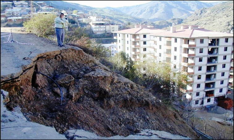
07 / 08.08.1998 TRABZON-BEŞKÖY LAYER: 50 people lost their lives and 101 houses were destroyed. Trabzon, which is located in the northeast region near the Black Sea, is one of the areas where landslides most commonly occur. Between 1950 and the present, there have been more than 270 landslides in Trabzon. The factors affecting the occurrence of landslides are the morphology of the region, geological structure, weathering of rocks, meteorological characteristics, settlement types, and various types of excavation work. Heavy precipitation, sloping topography, and the removal of forests for agricultural purposes increase the landslide risk.
AYVACIK LANDSLIDE 12 / 02/2017
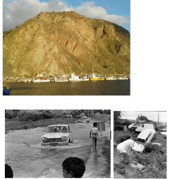
Following the recent earthquake of 5.3, a mountain slip on the mountain near the Babakale Harbor in the Ayvacik district came to the scene. There was a landslide during an earthquake on a steep slope at Babakale Harbor, which is very close to the earthquake zone.